
آزمایشگاه فتوگرامتری رقومی - آزمایشگاه های آموزشی و پژوهشی
آزمایشگاه فتوگرامتری رقومی
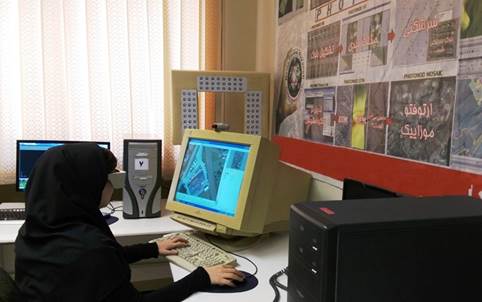
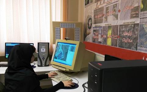
یکی از زیرساختهای اساسی پژوهش و فناوری در دانشگاه توسعه آزمایشگاه های تحقیقاتی و در راستای اهداف پژوهش و فناوری دانشگاه میباشد که ایجاد و توسعه آنها متناسب با شرایط روز و در راستای رفع نیازهای کشور و برنامه راهبردی دانشگاه می باشد.
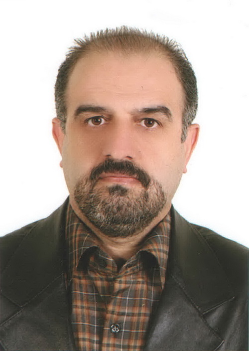
آزمایشگاه فتوگرامتری رقومی در سال ۱۳۸۸ به عنوان مرکز آموزشی و تحقیقاتی توسط دکتر حمید عبادی و گروهی از پژوهشگران و دانشجویان ایشان دردانشکده مهندسی نقشه برداری دانشگاه صنعتی خواجه نصیر طوسی تأسیس شد. این تیم پژوهشی، به عنوان زیرمجموعه دانشکده ژئودزی و ژئوماتیک در حال حاضر با ۵ دانشجوی دکتری و ۸ دانشجوی کارشناسی ارشد فعال مشغول به تحقیق و ارائه خدمات میباشند.
آزمایشگاه فتوگرامتری رقومی در سال ۱۳۸۸ به عنوان مرکز آموزشی و تحقیقاتی توسط دکتر حمید عبادی و گروهی از پژوهشگران و دانشجویان ایشان دردانشکده مهندسی نقشه برداری دانشگاه صنعتی خواجه نصیر طوسی تأسیس شد. این تیم پژوهشی، به عنوان زیرمجموعه دانشکده ژئودزی و ژئوماتیک در حال حاضر با ۵ دانشجوی دکتری و ۸ دانشجوی کارشناسی ارشد فعال مشغول به تحقیق و ارائه خدمات میباشند.
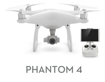
- کوادراتور فانتوم ۴
- نرم افزارهای تبدیل فتوگرامتری: Photomod – Inpho – LPS
- Agisoft - australis - photomodele
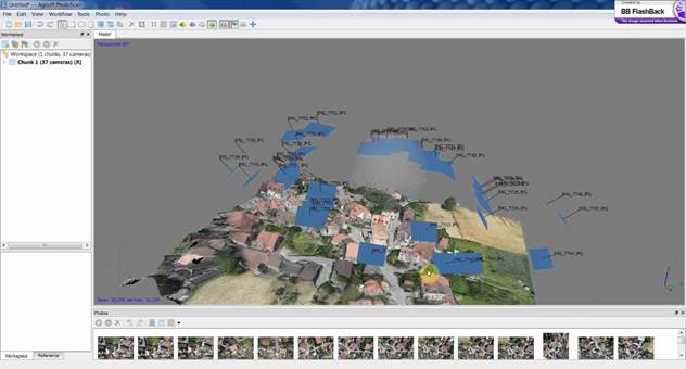
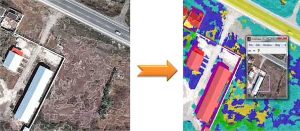
- استخراج اتوماتیک عوارض از تصاویر هوایی و ماهواره ای (استخراج عارضه ساختمان، جاده و ...)
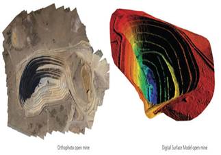
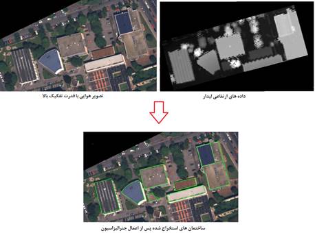
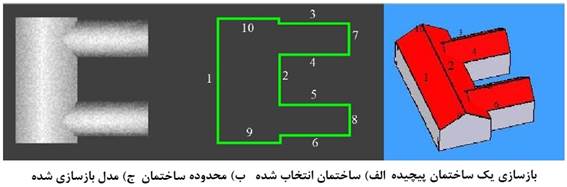
- طبقهبندی و شناسایی عوارض از تصاویر با قدرت تفکیک بالا
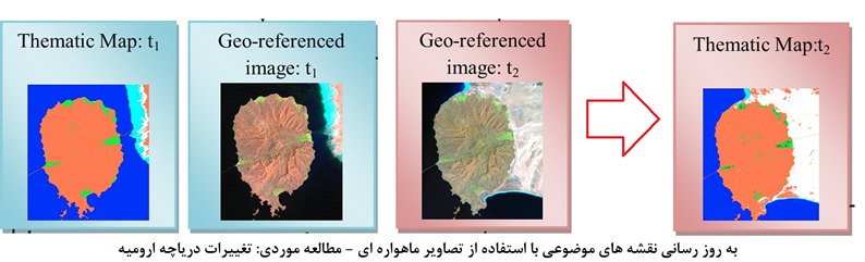
- به روز رسانی اطلاعات مکانی بااستفاده از تصاویر هوایی و سنجش ازدور
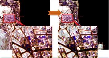
- استخراج اطلاعات کیفی و کمی از تصاویر راداری
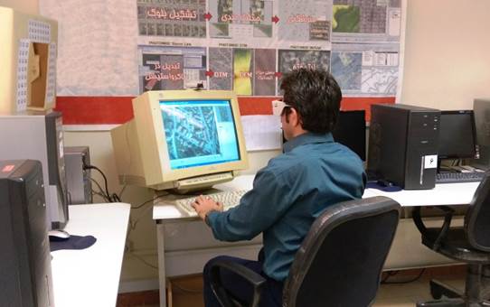
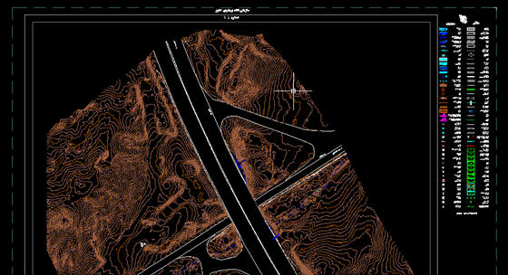
- تولید نقشههای بزرگ مقیاس از تصاویر هوایی و ماهوارهای با حد تفکیک بالا با استفاده از نرمافزارهاي فتوگرامتري رقومي Erdas،Photomod و Info
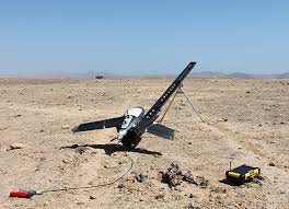
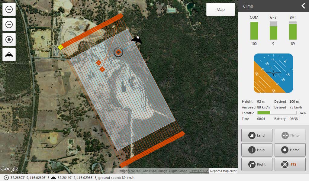
- طراحی و پرواز با رباتهای پرنده و تولید نقشه و ارتوفتو
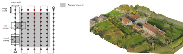
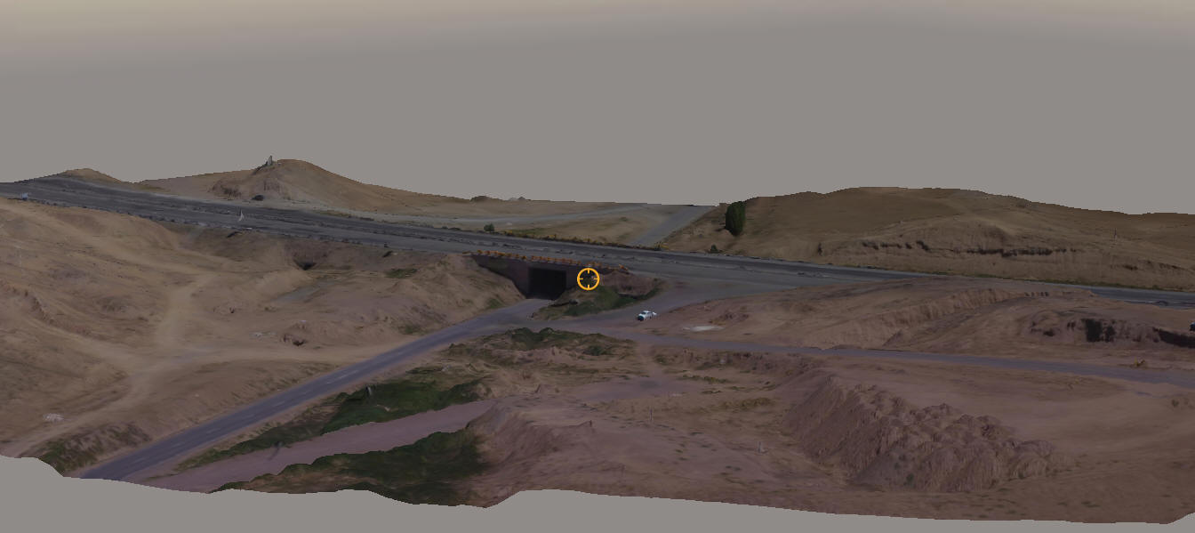
- تولید مدل سهبعدی
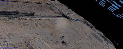
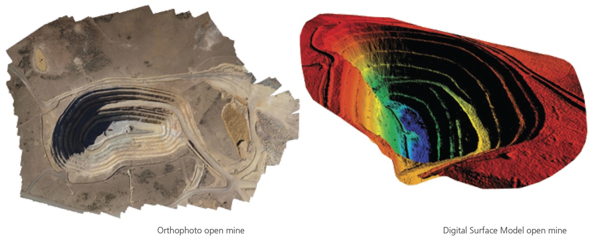
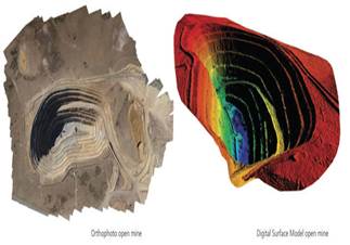
- تولید اتوماتیک ارتوفتو و مدل رقومی زمین از تصاویر هوایی و ماهواره ای
- تحقیق و توسعه سیستمهای فتوگرامتری به منظور نقشهبرداری از ابنیه های تاریخي
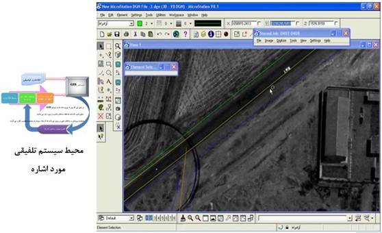
- تلفیق آنی و برخط سیستمهای فتوگرامتری و GIS
- تحقیق و توسعه سیستمهای فتوگرامتری به منظور نقشهبرداری از ابنیه های تاریخي
- تلفیق آنی و برخط سیستمهای فتوگرامتری و GIS
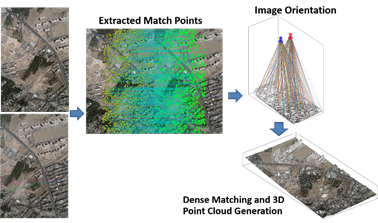
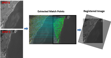
- تناظریابی اتوماتیک تصاویر هوایی و ماهواره ایGIS
نرم افزار های فتوگرامتری رقومی
مقاله و مطلب علمی
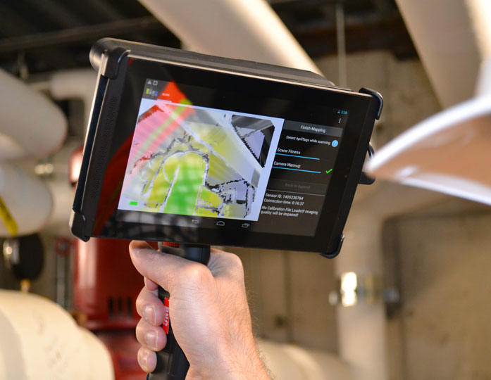
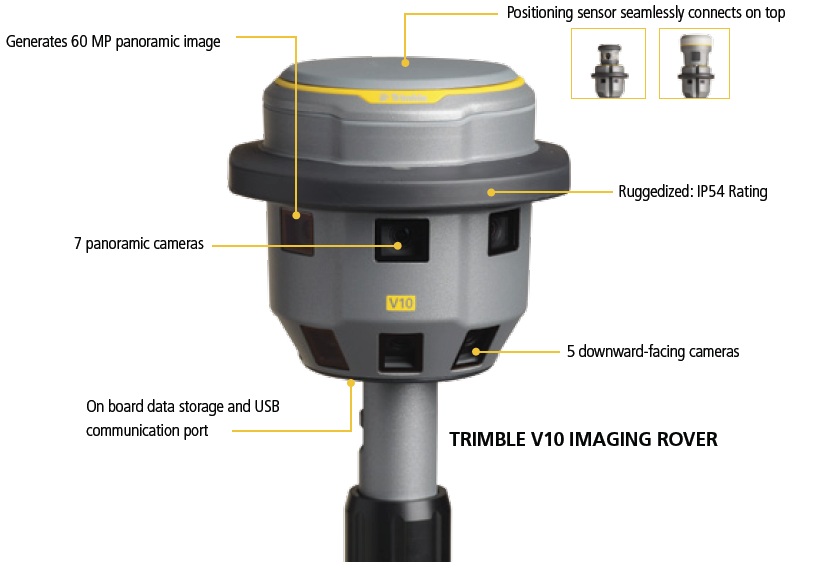
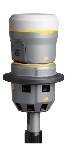
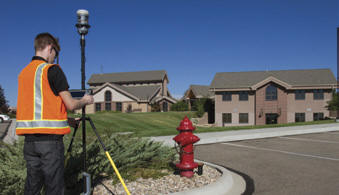
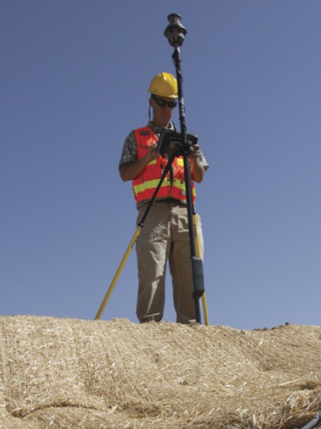
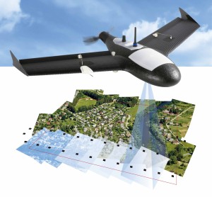
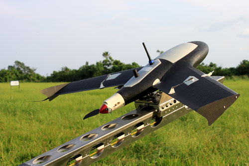
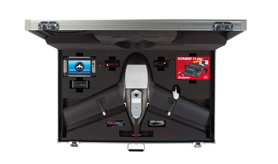
Ten Questions on Using a Camera for Measuring & Modeling (How photogrammetry software will change the way you work)
? How accurate is photogrammetry*
? How hard is it to learn photogrammetry and get my first resul*
? What cameras are best for photogrammetry*
?How do I take photos*
? How much time does it take to complete a project and how automated is it*
? Can I export photogrammetry files to other applications*
?What types of objects are best for photogrammetry*
? Can I use existing or known measurements to improve my photogrammetry project*
? How much will it cost*
*? How do I get started*
? How accurate is photogrammetry*
? How hard is it to learn photogrammetry and get my first resul*
? What cameras are best for photogrammetry*
?How do I take photos*
? How much time does it take to complete a project and how automated is it*
? Can I export photogrammetry files to other applications*
?What types of objects are best for photogrammetry*
? Can I use existing or known measurements to improve my photogrammetry project*
? How much will it cost*
*? How do I get started*
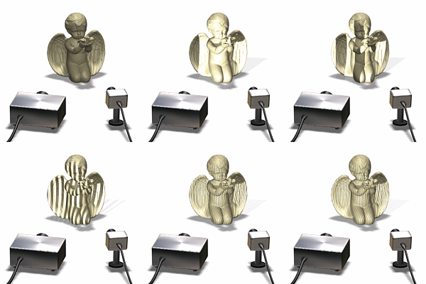
فزایش قدرت تفکیک مدل سه بعدی اسکن شده توسط اسکنر سه بعدی به روش نور ساختار یافته DAVID - قابلیت تشکیل مدل سه بعدی از اثر انگشت به روش نور ساختار يافته
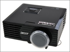
!Now you can buy our SL projector K۱۱+ (which is part of our SLS-۱ scanner package) separately. This projector is is just perfect for Structured Light scanning with DAVID
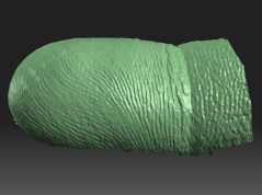
Its unique feature is the huge focus range: We build in a special optics for focus distances from below ۹۰mm to "infinity". This allows high-res scans of objects smaller than ۵۰mm, but also scanning large objects is possible. We have seen no other projector that is able to project patterns fine enough for scanning even fingerprints in ۳D
|
ایجاد مدل سه بعدی اثر انگشت به وسیله اسکن به روش نور ساخت یافته
|
The resolution of ۸۵۸*۶۰۰ is sufficient for high-detailed scans, especially with DAVID's intelligent sub-pixel accuracy algorithms. The projector has various inputs, so it can be connected to any desktop or laptop computer
Also we have improved its tripod mount, so the projector can be reliably mounted on a (mobile) scanner platform
پروژه های پژوهشی و اجرایی در دست اجرا در آزمایشگاه فتوگرامتری رقومی
پروژه های پژوهشی و اجرایی انجام شده در آزمایشگاه فتوگرامتری رقومی
- " نظارت عالی بر سیستم اطلاعات جغرافیایی صنعت برق بخش انتقال و فوق توزیع"، شرکت توانیر، ۱۳۹۵
- "طراحی و پیاده سازی سیستمی جهت کنترل و پایش دیواره های گودبرداري و سازه هاي مهار آنها با استفاده از فتوگرامتري برد کوتاه"، صندوق حمايت ازپژوهشگران کشور،.۱۳۹۵
- "طراحی وپیادهسازی سیستم رابطی جهت اتصال آنی محیط تبدیل فتوگرامتري و پايگاه داده مکاني اوراکل به منظور تبادل آني دادههاي مکاني محيط تبديل و سيستم بروزرساني داده هاي مکاني شهرداري تهران"،
پروژه های پژوهشی و اجرایی انجام شده در آزمایشگاه فتوگرامتری رقومی
- "بررسی روشهای آشکارسازی تغییرات از تصاویر ماهوارهای" ، سازمان فضایي ايران، ۱۳۹۱
- " انجام خدمات مشاوره و نظارت عالی برسیستم اطلاعات جغرافیایی صنعت برق بخش انتقال وفوق توزیع"، شرکت توانیر ۱۳۹۱.
- "امکان سنجی، نیازسنجی، طراحی مفهومی و پیاده سازی سیستمي جهت تلفيق آني سيستمهاي فتوگرامتري و GIS به منظور آماده ساي اطلاعات ساختار يافته براي GIS با تأکيد بر شناسايي و رفع خطاهاي هندسي" ، سازمان جغرافيايي نيروهاي مسلح، ۱۳۹۲.
- " استخراج اتوماتیک اطلاعات مکانی ازتصاویر با قدرت تفکیک بالا جهت تولید نقشه های ۱:۲۰۰۰" سازمان جغرافیایي نيروهاي مسلح، سازمان جغرافيايي نيروهاي مسلح"، ۱۳۹۳.
وحید صادقی، حمید عبادی، فرشید فرنود احمدی، "نرمالیزاسیون اتوماتيک تصاوير ماهوارهاي چند زمانه با استفاده از شبکههاي عصبي مصنوعي و پيکسلهاي تغيير نيافته"، نشريه علمي پژوهشي مهندسي فناوري اطلاعات مکاني، سال دوم، شماره نخست، صفحات ۳۹-۱۷، ۱۳۹۳.
وحید صادقی، حمید عبادی، محمودرضا صاحبی، یاسر مقصودی، فرشید فرنود احمدي، " آشکارسازي خودکار تغييرات در تصاوير ماهوارهاي چند زمانه مبتني بر حد آستانه گذاري با الگوريتم بهينه سازي توده ذرات"، سنجش از دور و GIS ايران، شماره يکم، صفحات ۱۷-۳۴، ۱۳۹۳.
روح ا... یزدان، محمد جواد ولدان زوج، حمید عبادی، علی محمدزاده، "استخراج نیمه اتوماتیک ساختمان با استفاده از مدل Snake از تصاویر هوایي با قدرت تفکيک مکاني بالا"، علوم و فنون نقشه برداري، شماره ۲، صفحات ۱۷۹-۱۸۸، ۱۳۹۳.
وحید صادقی، حمید عبادی، محمودرضا صاحبی، یاسر مقصودی، فرشید فرنود احمدي، " آشکارسازي خودکار تغييرات در تصاوير ماهوارهاي چند زمانه مبتني بر حد آستانه گذاري با الگوريتم بهينه سازي توده ذرات"، سنجش از دور و GIS ايران، شماره يکم، صفحات ۱۷-۳۴، ۱۳۹۳.
روح ا... یزدان، محمد جواد ولدان زوج، حمید عبادی، علی محمدزاده، "استخراج نیمه اتوماتیک ساختمان با استفاده از مدل Snake از تصاویر هوایي با قدرت تفکيک مکاني بالا"، علوم و فنون نقشه برداري، شماره ۲، صفحات ۱۷۹-۱۸۸، ۱۳۹۳.
Farshid Farnood Ahmadi, Hamid Ebadi, "Using Cognitive Information in the Expert Interface System for Intelligent Structuring and Quality Control of Spatial Data Measured from Photogrammetric or Remotely Sensed Images," Measurement, vol ۴۸, pages ۱۷۲-۱۶۷ ۲۰۱۴.
Abbas kiani, Hamid Ebadi, Farshid farnood Ahmadi, Salim Masoumi, "Design and implementation of an expert interpreter system for intelligent acquisition of spatial data from aerial or remotely sensed images", Measurement, vol ۴۷, pages ۶۸۵-۶۷۶, ۲۰۱۴.
D.yari, M.Mokhtarzade, H.ebadi, “Automatic Reconstructin of regular buildings using a shape-based balloon snake model”, THE PHOTOGRAMMETRIC RECORD, ۲۹No۱۴۶, pages ۱۸۷-۲۰۵, ۲۰۱۴.
Amin Sedaghat, Hamid Ebad,” Accurate Affine Invarial Image Matching Using Oriented Least Square”, vol ۸۱-۹, pages ۷۳۳-۷۴۳, ۲۰۱۴
.
وحید صادقی، حمید عبادی، محمودرضا صاحبی، یاسر مقصودی، فرشید فرنود احمدي، "آشکارسازي خودکار تغييرات در تصاوير ماهوارهاي چندزمانه مبتني بر حد آستانه گذاري با الگوريتم بهينه سازي توده ذرات"، سنجش از دور و GIS ايران، شماره يکم، صفحات ۳۴-۱۷، ۱۳۹۴.
Abbas kiani, Hamid Ebadi, Farshid farnood Ahmadi, Salim Masoumi, "Design and implementation of an expert interpreter system for intelligent acquisition of spatial data from aerial or remotely sensed images", Measurement, vol ۴۷, pages ۶۸۵-۶۷۶, ۲۰۱۴.
D.yari, M.Mokhtarzade, H.ebadi, “Automatic Reconstructin of regular buildings using a shape-based balloon snake model”, THE PHOTOGRAMMETRIC RECORD, ۲۹No۱۴۶, pages ۱۸۷-۲۰۵, ۲۰۱۴.
Amin Sedaghat, Hamid Ebad,” Accurate Affine Invarial Image Matching Using Oriented Least Square”, vol ۸۱-۹, pages ۷۳۳-۷۴۳, ۲۰۱۴
.
Amin Sedaghat, Hamid Ebad, “Distinctive order based self-similarity descriptor for multi-sensor remote sensing image matching”, ISPRS journal of photogrammetry and remote sensing,vol ۱۰۸, pages ۶۲-۷۱, ۲۰۱۵.
Amin Sedaghat, Hamid Ebad, “Remote sensing image matching based on adaptive binning sift descriptor”, vol ۵۳No۱۰, pages ۵۲۸۳-۵۲۹۳, ۲۰۱۵.
Amin Sedaghat, Hamid Ebad,” Very High Resolution Image Matching Based on Local Features and k-Means Clustering”, The photogrammetric record, vol ۳۰No ۱۵۰, pages ۱۶۶-۱۸۶, ۲۰۱۵.
M. manafifard, H. Ebadi, H. Abrishami Moghadam,” Discrete Particle Swarm Optimization for Player Trajectory Extraction in Soccer Broadcast Videos”, Scientica Iranica, vol ۳, pages ۱۰۳۱-۱۰۴۴, ۲۰۱۵
.
آرمین مقیمی، حمید عبادی، وحید صادقی، " نرمالیزاسيون راديومتريک اتوماتيک تصاوير ماهوارهاي چند زمانه مبتني بر تبديل"، IR-MAD و شبکه هاي عصبي مصنوعي، علوم و فنون نقشه برداري، شماره ۴، صفحات ۲۰۹-۲۲۱، ۱۳۹۴.Amin Sedaghat, Hamid Ebad, “Remote sensing image matching based on adaptive binning sift descriptor”, vol ۵۳No۱۰, pages ۵۲۸۳-۵۲۹۳, ۲۰۱۵.
Amin Sedaghat, Hamid Ebad,” Very High Resolution Image Matching Based on Local Features and k-Means Clustering”, The photogrammetric record, vol ۳۰No ۱۵۰, pages ۱۶۶-۱۸۶, ۲۰۱۵.
M. manafifard, H. Ebadi, H. Abrishami Moghadam,” Discrete Particle Swarm Optimization for Player Trajectory Extraction in Soccer Broadcast Videos”, Scientica Iranica, vol ۳, pages ۱۰۳۱-۱۰۴۴, ۲۰۱۵
.
عباس کیانی، حمید عبادی، " توسعه روشی نوین در تشخیص لبه تصاویر هوايي/ ماهوارهاي با قدرت تفکيک بالا با تأکيد بر بهينه سازي حدود آستانه و استفاه از الگوريتم رقابت استعماري"، علوم و فنون نقشه برداري، شماره ۴، صفحات ۶۷-۸۲، ۱۳۹۴.
حمیدرضا اورعی، مهدی مختارزاده، حمید عبادی، " تلفیق نتایج چند طبقه بندی کننده فازي با استفاده از قوانين اتصال در فضاي توپولوژي فازي"، سنجش از دور و GIS ايران، ۱۳۹۴.
سید مقداد هاشمی نسب، حمید عبادی، علی حسینی نوه احمد آبادیان، امين صداقت، "بهبود الگوريتم SHFT به منظور تناظريابي تصاوير برد کوتاه با طول باز بلند" نشريه علمي پژوهشي مهندسي فناوري اطلاعات مکاني، سال سوم، شماره سوم، صفحات ۷۴-۵۲، ۱۳۹۴.
امیر آقابالایی، حمید عبادی، یاسر مقصودی، "طبقه بندی پوششهاي جنگلي با استفاده از داده هايcompact پلاريمتري"، مجله علوم و فنون نقشه برداري، دوره ۵، شماره ۳، ۱۳۹۴.
Vahid Sadeghi, Farshid Farnood Ahmadi, Hamid Ebadi ,“Design and Implementation of an Expert System for Updating Thematic Maps using satellite imagery (Case Study, Changes of Lake Urmia), Arab J Geosc I, pages ۱-۲۱,۲۰۱۵.
Vahid Sadeghi, Farshid Farnood Ahmadi, Hamid Ebadi, “A new automatic regression-based approach for relative radiometric normalization of multitemporal satellite imagery”, Comp. Appl. Math., pages ۱-۱۸, ۲۰۱۵.
Mahin Shokrollahi۱, Hamid Ebadi” Improving the Accuracy of Land Cover Classification Using Fusion of Polarimetric SAR and Hyperspectral Images”, J Indian Soc Remote Sens pages ۱-۸, ۲۰۱۶.
M. Manafifard, H. Ebadi, H. Abrishami Moghaddam, “Multi-player detection in soccer broadcast videos using a blob-guided particle swarm optimization method”, Multimed Tools Appl, ۲۰۱۶
.
آرمین مقیمی، صفا خزایی، حمید عبادی، "آشکارسازی نظارت نشده تغييرات از تصاوير ماهواره اي چندزمانه SAR مبتني بر بهبود تئوري سطوح هم تراز"، مجله علمي پژوهشي رادار، سال چهارم، شماره ۱، بهار ۱۳۹۵، صفحات ۶۸-۵۷.Vahid Sadeghi, Farshid Farnood Ahmadi, Hamid Ebadi, “A new automatic regression-based approach for relative radiometric normalization of multitemporal satellite imagery”, Comp. Appl. Math., pages ۱-۱۸, ۲۰۱۵.
Mahin Shokrollahi۱, Hamid Ebadi” Improving the Accuracy of Land Cover Classification Using Fusion of Polarimetric SAR and Hyperspectral Images”, J Indian Soc Remote Sens pages ۱-۸, ۲۰۱۶.
M. Manafifard, H. Ebadi, H. Abrishami Moghaddam, “Multi-player detection in soccer broadcast videos using a blob-guided particle swarm optimization method”, Multimed Tools Appl, ۲۰۱۶
.
وحید صادقی، حمید عنایتی، حمید عبادی، بهبود شناسایي تغييرات در مناطق شهري با انتخاب ويژگيهاي طيفي و مکاني بهينه مبتني بر الگوريتم ژنتيک"، مجله علمي پژوهشي سپهر، ۱۳۹۵ صفحات ۱۵۲-۱۳۵.
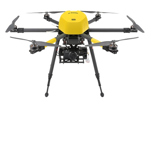
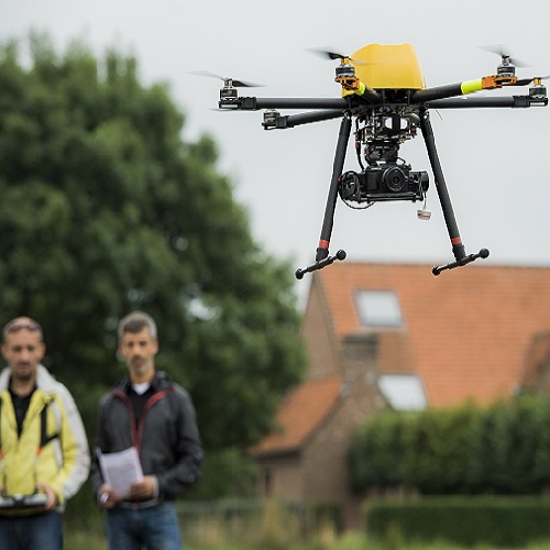
- پرواز تخصصی با سیستم های UAV از نوع Quadrotor و تهیه نقشه ها و مدل های سه بعدی هوایی و برد کوتاه
- طراحی و و برنامه نویسی ماژول های نرم افزاری تخصصی فتوگرامتری برد کوتاه با اهداف مشخص
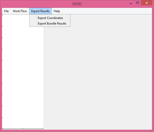
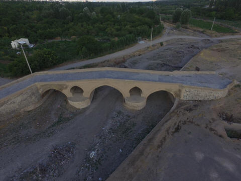
- انجام فعالیت های اجرایی و پژوهشی در حوزه فتوگرامتری برد کوتاه در کاربرد های صنعتی، پزشکی، عمرانی، میراث فرهنگی
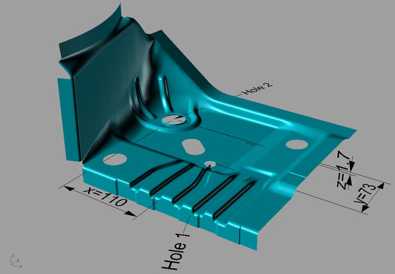

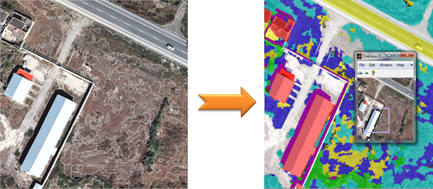
- طبقه بندی و قطعه بندی با استفاده از تصاویر ماهواره ای
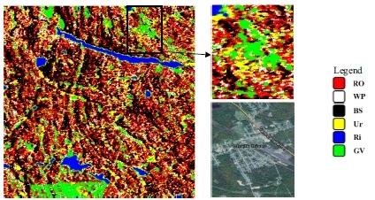
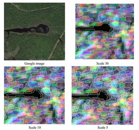
- طبقه بندی، قطعه بندی و تشخیص تغییرات با استفاده از تصاویر راداری
این آزمایشگاه از سال ۱۳۹۹ در قالب آزمایشگاه های شاعا برای تمام محققین کشور ارائه خدمات می نماید.
آدرس الکترونیکی آزمایشگاه در سایت شبکه آزمایشگاه های علمی ایران:
https://emshaa.msrt.ir/LabInfo/Index/۵۸۶۴
آدرس الکترونیکی آزمایشگاه در سایت شبکه آزمایشگاه های علمی ایران:
https://emshaa.msrt.ir/LabInfo/Index/۵۸۶۴
A paragraph is a self-contained unit of a discourse in writing dealing with
a particular point or idea. Paragraphs are usually an expected part of
formal writing, used to organize longer prose.
A paragraph is a self-contained unit of a discourse in writing dealing with
a particular point or idea. Paragraphs are usually an expected part of
formal writing, used to organize longer prose.
A paragraph is a self-contained unit of a discourse in writing dealing with
a particular point or idea. Paragraphs are usually an expected part of
formal writing, used to organize longer prose.
اساتید همکار:
دکتر حمید عبادی (سرپرست آزمایشگاه - استاد دانشکده نقشه برداری دانشگاه صنعتی خواجه نصیر الدین طوسی)
دکتر فرشید فرنود احمدی - دانشیار دانشگاه تبریز
دکتر مصطفی کابلی زاده - استادیار دانشگاه شهید چمران اهواز
دکتر سلمان احمدی - استادیار دانشگاه کردستان
دکتر امین صداقت - استادیار دانشگاه تبریز
دکتر وحید صادقی هزه بران - استادیار دانشگاه تبریز
دانشجویان دکتری همکار در آزمایشگاه:
مهندس عباس کیانی
مهندس امیر آقابالایی
مهندس عبدالله کیانژآد
مهندس فرید اسماعیلی
دانشجویان کارشناسی ارشد همکار در آزمایشگاه:
مهندس زهرا همتی
مهندس الهه تمیمی
مهندس شیوا حق شناس
دانشجویان کارشناسی همکار در آزمایشگاه:
آقای وحید هاشمی
آقای علی عربی
خانم مؤمنی خو
دکتر حمید عبادی (سرپرست آزمایشگاه - استاد دانشکده نقشه برداری دانشگاه صنعتی خواجه نصیر الدین طوسی)
دکتر فرشید فرنود احمدی - دانشیار دانشگاه تبریز
دکتر مصطفی کابلی زاده - استادیار دانشگاه شهید چمران اهواز
دکتر سلمان احمدی - استادیار دانشگاه کردستان
دکتر امین صداقت - استادیار دانشگاه تبریز
دکتر وحید صادقی هزه بران - استادیار دانشگاه تبریز
دانشجویان دکتری همکار در آزمایشگاه:
مهندس عباس کیانی
مهندس امیر آقابالایی
مهندس عبدالله کیانژآد
مهندس فرید اسماعیلی
دانشجویان کارشناسی ارشد همکار در آزمایشگاه:
مهندس زهرا همتی
مهندس الهه تمیمی
مهندس شیوا حق شناس
دانشجویان کارشناسی همکار در آزمایشگاه:
آقای وحید هاشمی
آقای علی عربی
خانم مؤمنی خو
آخرین بهروزرسانی: